Garmin Bluechart G3 South America West - HSA002R

Free Ground Shipping!

Garmin Bluechart G3 South America West - HSA002R

Garmin Bluechart G3 South America West - HSA002R
Includes Coverage of the west coast of Central and South America from Acalpulco, Mexico to Tierra del Fuego and then north to Puerto Deseado, Argentina. Coverage also includes the east coast of Panama; the Panama Canal; the Galapagos Islands; Lake Titicaca; the Falkland Islands (Islas Malvinas); San Felix Island and the San Fernandez Islands including Selkirk.
  • SKUGAXC10632
  • MAN#010-C1063-20
  • ID#: 2995
Our Price:
$139.95
Availability: 
In Stock
Shipping:
Free Ground Shipping!
Condition:
Brand New

Garmin Bluechart G3 with Navionics Data

 Authorized Garmin Dealer

Please note, Garmin G3 and G3 Vision Charts are NOT compatible with any unit pre-programmed with GN+ Charting, Please see Garmin Navionics Plus and Garmin Navionics Vision Plus Charts for GN+ units.

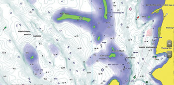
Get a new perspective on navigation with Garmin BlueChart g3 coastal marine cartography. Integrated Garmin and Navionics content provide the following mapping features in addition to navigational aids, spot soundings, tides and currents. Simply plug the SD card into your compatible Garmin MFD and enjoy the benefits of Garmin g3 Mapping.

Auto guidance technology- Will search the attributes of all relevant charts to suggest the best course for navigation taking into consideration your desired safe depth and overhead clearance.
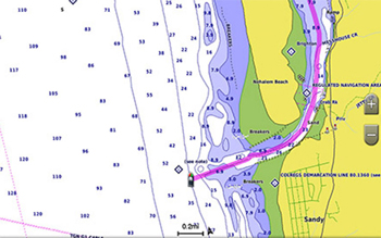
Garmin Bluechart G3 Auto Guidance

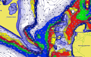
Depth Range Shading- For up to 10 depths so you can view your designated target depth

Shallow Water Shading- Allows for user defined depths, showing a clear picture of shallow waters to avoid

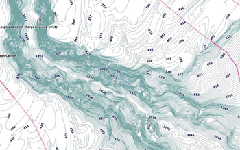
1-foot HD contours- Provide a more accurate depiction of bottom structure for improved fishing charts and navigation in swamps, canals, marinas and port plans

Garmin Bluechart G3 1 Foot Contours

 Genuine Garmin Maps