GPS Units - Accessories
Autopilots - Marine
Cameras
Chart Plotters
Communications
Dash Cameras
EPIRBs & PLBs
Fitness, Sports & Golf
Fishfinders
Garmin Fitness
GPS-Fishfinders
GPS-GMRS Radios
Maps & Software
Hiking & Handheld GPS
Wearables
Laptop & Tablet GPS
Marine Electronics
Motorcycle Units
Network Systems
Off Road GPS
Radars
Safety Equipment
Starlink Mounts
Stereos & Speakers
Top Choice Products
Tracking Devices
Trolling Motors
Truck & RV GPS
VHF Radios
Accessories
Garmin Accessories
Marine Accessories
Transducers
Actisense
B&G
BilgeBuddy
Blue Sea Systems
C-Map Charts
CMOR Charts
Flir Thermal Imaging
Fujinon Marine Binoculars
Furuno Marine Electronics
Fusion Stereos
Garmin GPS
Icom Marine Radios
JL Audio
KVH Satellite TV
Lowrance Electronics
Lumishore LED Lights
Magellan GPS Systems
Navionics Charts
Ocean Signal
Pelican Lights
Poly Planar Stereos
Raymarine Electronics
Scanstrut
Seaview Mounts
Shakespeare
Simrad Marine
Sionyx
Si-Tex Marine Electronics
Standard Horizon
Superior Life Saving Life Rafts
USGlobalSat
Veratron
Vesper Marine
Understanding AIS, Part 1
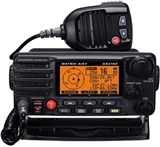
Automatic Identification System – or AIS – is one of the hottest product categories in marine electronics. In recent years, most manufacturers have added AIS products to their recreational product lines, either as a "Stand-Alone AIS", "AIS/VHF Combo" or “Black Box” modules that have no displays of their own but provide AIS target information to compatible systems such as chartplotters, PCs and radar.

Some boaters were early adapters who immediately jumped on the AIS bandwagon. Many other boaters are still trying to figure out if AIS is something they really need and will make use of. One thing is certain, as AIS technology becomes widely available, more accepted and more affordable, it will find its way onto more vessels — especially as older marine electronics packages are replaced with new, integrated helm systems.
The experts at The GPS Store want to help boaters make informed decisions about AIS, to ensure they end up with a system that meets their needs and suits their boating lifestyle. We’ll start with some basic explanation of what AIS is and how it works, and then explore some of the practical applications uses of AIS for recreational boaters in Part 2.
What is AIS? Wikipedia defines AIS as an automatic tracking system used on ships and by vessel traffic services for identifying and locating vessels by electronically exchanging data with other nearby ships and AIS Base stations. It also describes AIS as a supplement to marine radar for the purposes of collision avoidance. It does this by providing data such as unique ID, position, bearing, course, speed and other information to other AIS equipped vessels or land stations. This information also includes vessel size, destination and dangerous cargo, if any.
If you’re new to the AIS scene, you may be confused by talk of Class A and Class B AIS. Class A AIS is “commercial grade” equipment mandated by the International Maritime Organization (IMO) for international voyaging ships of 300+ tons and all passenger ships regardless of size. Although there is nothing preventing recreational vessels from carrying Class A AIS, expense is often a barrier — particularly considering the wide availability of affordable Class B systems that perform the functions most boaters need.
Class A systems must have an integrated display, cannot be made “silent” and transmit at 12W for an effective range of 40+ miles. Recreational Class B systems transmit at 2W for an effective maximum transmission range of five to 10 miles. Vessel owners can choose “receive only” Class B units or shut off their Class B transmitters, for occasions where they don’t want to broadcast their vessel’s data.
Both Class A and Class B units receive all types of AIS signals. Every AIS unit that transmits must be registered with the vessel’s Maritime Mobile Service Identity (MMSI), a nine-digit ID number exclusive to each vessel.
To Send or Receive, That is the Question!
Boaters considering Class B AIS have to decide whether they desire a unit that sends and receives AIS signals (Class B AIS transceiver) or just receives (Class B AIS receiver). Both have safety benefits for recreational boaters. A receiver allows you to see and track AIS-equipped vessels in your area, providing the operator with improved situational awareness. A transceiver adds the ability for other AIS equipped vessels to see and track you — important for safe navigation, keeping vessels in group activities like tournament fishing or sailing regattas together, or for speeding aid to your position in emergency situations.

The Right System for the Right Boat!
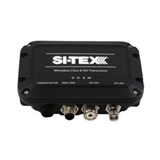
There are many options in Class B AIS — the right one for a given boat depends largely on where it will be installed and how it will be used. For smaller boats, a compact AIS module like the new SI-TEX Metadata — which is waterproof for flexible mounting — is inexpensive and ideal for integrating with existing navigation systems. It is available in both send/receive or receive only and features an internal 50-channel GPS smart antenna eliminating the need for an external GPS sensor. Hook this to a separate VHF antenna and onboard plotters, radar or PC with the built-in NMEA2000, NMEA013 or USB interface (which doubles as a power source for the module), and you have all critical AIS information available.
How you can view/use information provided by black box AIS units can vary based on the software in the device you’re connecting it to. You may only be able to view AIS “stick figures” and vessel information on the display, or you may be able to set up advanced functions like filtering of targets displayed by type and distance, or the ability to view AIS targets in different colors based by class of vessel. Boaters should investigate the AIS integration capabilities of their specific navigation systems, and check to see if any recent software updates have been issued by the manufacturer that could enhance these features.

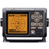
Several manufacturers also offer standalone AIS units with dedicated displays – from basic monochrome LCDs to large color screens with high-detail charting capabilities. These require more installation room on the helm and cost more to purchase, but can offer more advanced AIS functions, such as the ability to monitor position, speed and heading of vessels on a “radar” style display with range rings, set alarms for Closest Point of Approach (CPA) and Time to Closest Point of Approach (TCPA), filter/analyze AIS target data, and more.
If you frequently fish or navigate in crowded shipping lanes or heavily trafficked commercial waterways and full-time, dedicated monitoring of all AIS targets is important to you, a dedicated Class B system with its own display may better meet your needs.
Part 2 of this series will examine some of the practical ways boaters can use AIS technology to improve safety on the water and enhance the boating experience.
To learn more about a wide array of AIS products from top manufacturers, visit wwwTheGPSStore.com or call The GPS Store, Inc. at (800) 477-2611.
________________________________________________________________________________________________


